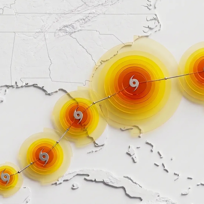
Google DeepMind has open sourced WeatherNext, an AI model that forecasts tropical cyclones with an extra day of accuracy—equivalent to a decade of meteorological progress.
The model predicts cyclone track, intensity, and wind structure by combining global weather dynamics with historical cyclone data, and already helped the National Hurricane Center issue advance warnings for Hurricane Melissa in 2025.
Meteorological agencies and researchers worldwide can now access the code, weights, and forecasts to better prepare for destructive storms.
What happened
Google DeepMind released WeatherNext, an AI model that predicts cyclone track, intensity, and wind structure with state-of-the-art accuracy. The model gives forecasters an extra day's worth of predictive accuracy—three-day forecasts match what prior models could only deliver for two days. The code and weights are now open source. During the 2025 hurricane season, WeatherNext helped the National Hurricane Center predict Hurricane Melissa's rapid intensification and landfall in Jamaica, enabling an advance warning.
Why it matters
Tropical cyclones have caused more than 700,000 deaths and $1.4 trillion in economic losses globally over the past 50 years. An extra day of forecast lead time is equivalent to roughly a decade's worth of meteorological progress. By open sourcing the model, Google aims to help meteorological agencies, researchers, and nonprofits worldwide better predict weather events and protect lives and infrastructure.
What to watch
WeatherNext now predicts 1,000 possible scenarios for each cyclone (up from 50 last year) to help forecasters assess rare but severe outcomes like rapid intensification. A smaller version, WeatherNext 2-mini, runs on a single TPU in a free public Colab notebook. Forecasts and visualizations are available on Weather Lab, which Google recently expanded to show global weather predictions alongside cyclone tracks.
Tropical cyclones—hurricanes and typhoons—rank among Earth's most destructive phenomena. Over the past 50 years, they have killed more than 700,000 people and caused $1.4 trillion in economic losses globally. For forecasters, every hour of warning is precious. On September 19, Google DeepMind published a paper in Nature describing WeatherNext, an AI model that achieves state-of-the-art accuracy in predicting cyclone track, intensity, and wind structure. The breakthrough: three-day forecasts from WeatherNext are as accurate as what prior models could only deliver for two days—a full day of additional lead time. This scale of improvement roughly equals a decade's worth of meteorological progress.
The model was developed through collaboration among AI researchers at Google DeepMind and Google Research, alongside expert forecasters from the National Hurricane Center (NHC), the Cooperative Institute for Research in the Atmosphere (CIRA), the UK Met Office, and weather agencies worldwide. Operationally, WeatherNext proved itself during the 2025 hurricane season. When Hurricane Melissa struck in 2025, the model predicted the storm's rapid intensification and landfall in Jamaica, allowing the NHC to issue advance warnings that gave communities critical preparation time. This year, the team has scaled the forecast ensemble from 50 scenarios to 1,000 possible outcomes per cyclone, helping forecasters evaluate the probability distribution of potentially devastating tail-risks.
Traditionally, cyclone forecasting forced a choice between accuracy and scope. Global atmospheric models, which run at coarse resolution, excel at predicting track by capturing massive weather currents, but struggle with the fine-scale thermodynamic processes that drive intensity. High-resolution local models do the reverse. WeatherNext solves this by merging both capabilities in one AI model. It was trained end-to-end on two distinct data modalities: nearly 20 terabytes of global atmospheric data and the historical IBTrACS database, which contains observations of nearly 5,000 historical storms. By learning complex atmospheric patterns and how extreme weather evolves, the model can predict track, intensity, and wind structure simultaneously. The model uses Functional Generative Networks (FGNs) to efficiently produce ensembles and capture the inherent uncertainty of weather forecasting. Surprisingly, WeatherNext Cyclones achieves this accuracy with data at only 28x28km resolution—100x coarser than traditional intensity models. A smaller variant, WeatherNext 2-mini, operates at even coarser 111x111km resolution and still performs well. Scientists remain uncertain why such coarse inputs suffice, calling it an open research question. A single 15-day forecast now runs in less than a minute on a TPU.
Google is now open sourcing the code and model weights for WeatherNext Cyclones (the version used during the hurricane season, published in Nature) and WeatherNext 2 (operationalized in October), along with WeatherNext 2-mini, which runs on a single TPU in a free public Colab notebook. Forecasts are available on Weather Lab, which Google recently refreshed with a new interface and expanded to include global weather predictions—temperature, precipitation, wind speed—alongside cyclone tracks. All are part of Google Earth AI. The release invites researchers, meteorological agencies, and experts worldwide to build on the open-source models, conduct academic research, develop specialized localized variants, and explore the forecasts. By combining advanced machine learning with the expertise of human forecasters, Google frames this as a step toward a collaborative weather forecasting ecosystem designed to save lives and help communities adapt to a changing climate.
WeatherNext represents a fundamental shift in how AI tackles the dual challenge of cyclone forecasting. Traditionally, forecasters faced a trade-off: global atmospheric models could predict a cyclone's track (steered by massive, coarse weather patterns) but struggled with intensity (driven by fine-scale thermodynamic processes around the storm's core). WeatherNext bridges this gap with a single AI model trained end-to-end on nearly 20 terabytes of global atmospheric data and the historical IBTrACS database spanning nearly 5,000 storms. By learning complex atmospheric patterns and extreme-weather dynamics, the model gains more than 24 hours of lead time—a level of improvement unseen in decades of incremental progress.
The real-world proof came during the 2025 hurricane season, when WeatherNext enabled the National Hurricane Center to predict Hurricane Melissa's rapid intensification and landfall in Jamaica, translating into advance warnings that gave communities critical preparation time. This operational success validates the model's practical value beyond benchmarks. The decision to open source WeatherNext 2 and WeatherNext Cyclones further amplifies impact: meteorological agencies, researchers, and nonprofits worldwide now have access to the same breakthrough technology, rather than waiting for indirect adoption through official channels. The scaled ensemble approach—now generating 1,000 possible scenarios per cyclone instead of 50—better captures rare but catastrophic outcomes like rapid intensification, giving forecasters a fuller picture of tail risks they must prepare for.
AI-summarized, only the topics you pick — one digest a day via Email, Slack, or Discord.
Free · takes 30 seconds · unsubscribe anytime
Ask AI anything about this article. Q&As are published on this page for other readers too.

The AI news that matters, in one minute each morning.
Sign up free