What happened
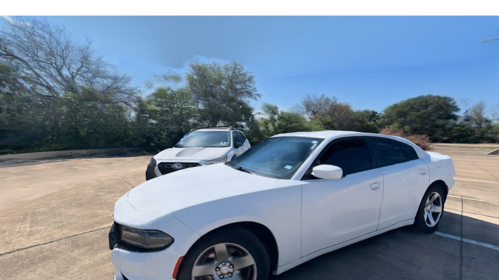
SkyeBrowse updated its 3D mapping platform with "Realistic 3D," which the company says processes video three times faster and delivers five times better quality than before.
Why it matters
Public safety and inspection teams rely on these models to document scenes, so the company claims faster output could help investigators review results or confirm coverage before leaving a location.
WHO IT HITSPublic safety agencies, accident reconstruction and crime scene investigators, fire investigators, and construction and infrastructure inspection teams that document physical locations with 3D models are the target users, along with prosecutors and command staff who review those visual records.
Summaries like this, every morning.
SkyeBrowse's platform is built on videogrammetry, which turns a single continuous video into 3D models and 2D maps rather than relying on sets of individual photographs as traditional photogrammetry workflows do. The new Realistic 3D update adds an AI engine that adjusts processing based on the scene and video source, and it can handle aerial drone footage, smartphone recordings, and video from 360-degree cameras.
The Photorealism mode works by blending video frames into the 3D scene when users view a model from positions along the original camera path. That preserves details such as reflections, windshield glare, and shadows that may not appear the same way in a standard textured model. As users move away from the original camera path, the display gradually returns to the standard 3D model. A separate Surroundings view places the model within the surrounding sky, trees, buildings, and other features captured in the original video, providing visual context rather than an empty background.
The update also expands how teams can document scenes. Universal Upload accepts MP4 and MOV files along with native INSV and OSV files from Insta360 cameras, so users do not need to convert those 360-degree files into MP4 format before uploading. This allows a drone to capture an overhead view of a crash scene while a smartphone records ground-level details and a 360-degree camera records interior spaces, all entering the same mapping platform. SkyeBrowse notes that visual realism and measurement accuracy are separate considerations, and a more realistic appearance does not by itself establish greater measurement accuracy.
Pick your industry and the AI tools you use, and get news related to your work every day.
Free · 30 seconds with Google · unsubscribe anytimeWhat is AIToday? →
Ask AI anything about this article. The AI reads this article, earlier AIToday articles, and Wikipedia, and cites its sources. Q&As are published on this page for other readers too.
The FCC voted November 19 to adopt rules covering the 450 MHz band for aviation communications, the 24 GHz ban…
Nvidia, Macnica Galaxy and SignalPro joined forces with Epson hardware to showcase an end-to-end ecosystem spa…

Isao Sukebara of SUGENA said at an October 29, 2026 online seminar that Chinese makers accounted for over 97%…

SoftBank is building a physical AI business model designed to generate revenue even when robots made by other…

SoftBank is pursuing a "physical AI" strategy that aims to generate revenue from robots built by other compani…

SOMPO Holdings and NTT concluded an agreement aimed at the social implementation of 'physical AI' in the nursi…