What happened
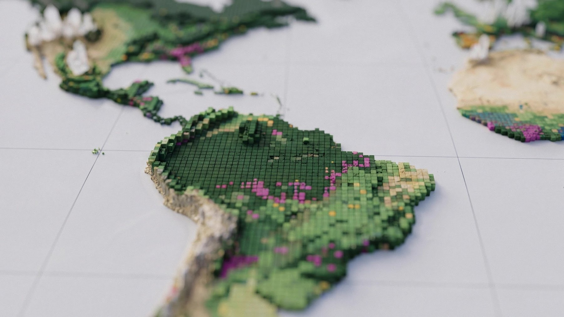
Google Deepmind and the World Resources Institute released ForTy, a freely available map assigning the world's 2020 land area to six classes at 10-meter resolution, from primary forest to oil palm, rubber and cocoa tree crops.
Why it matters
The map is the first global dataset of its kind, but it correctly identified only about half of tree crops and planted forests and 60% of plantations, so users must weigh its confidence scores when relying on it.
WHO IT HITSSupply-chain and sustainability analysts assessing land use will gain a global 2020 baseline, but those working with plantations and tree crops may need to treat the map's classifications with caution given its lower accuracy for those classes.
Summaries like this, every morning.
Satellite maps have long shown where trees grow, but not what kind of forest or crop is present. ForTy addresses that gap by building on Google DeepMind's AlphaEarth Foundations model, which compresses data from multiple satellites into a compact description of each 10-by-10-meter area. The project was driven in large part by the EU Regulation on Deforestation-free Products, which prohibits goods linked to forests cleared or degraded after December 31, 2020, and therefore needs a reliable 2020 reference point. Oil palm and cocoa farms count as agricultural land under those rules, so companies assessing supply chain risks need to know how a site was used in 2020.
Building that reference point is difficult because a forest's type depends on its history, not just its appearance. An old planted mixed forest can look natural from space, and a recently cleared plantation still counts as forest by definition even though satellite images show bare ground. ForTy uses three model stages and multiple active learning rounds in which experts added about 43,000 examples to correct errors such as vineyards in Europe classified as tree crops and oil palms missed in Africa and Indonesia. Even so, satellite images rarely show how land is managed, so the researchers used a 40-year rotation period to separate plantations from other planted forests—a cutoff that does not fit every region.
The map's overall accuracy of 90.2 percent gets a large boost from the easy-to-identify "other land" class, and results vary sharply by forest type. ForTy still outperforms European Commission maps made specifically for the EUDR on the same test data, scoring 95.5 percent compared with 93.6 percent for forest versus nonforest classification and 90.9 percent compared with 87.8 percent for forest types. The researchers estimate the world has about 4.1 billion hectares of forest, including nearly 3.9 billion hectares of natural forest, of which about 2 billion hectares are primary forest. Regional errors remain: the map overestimates primary forest in Asia by about 200 million hectares, largely in Russia's conifer forests, and misses about 94 million hectares of forest in Africa, likely because of open dry forests and savannas.
Pick your industry and the AI tools you use, and get news related to your work every day.
Free · 30 seconds with Google · unsubscribe anytimeWhat is AIToday? →
Ask AI anything about this article. The AI reads this article, earlier AIToday articles, and Wikipedia, and cites its sources. Q&As are published on this page for other readers too.
Microsoft is offering voluntary severance to about 60,000 employees—roughly a quarter of its workforce—across…
The authors say they dropped several planned entry-level marketing hires at around $60,000 each, hired one per…
Alphabet fell 12.6% Thursday, ServiceNow dropped 27%, and Intel fell roughly 25% premarket Friday, wiping near…

Across earnings calls and WIRED interviews covering roughly 50 companies, DoorDash called Muse and other agent…

Uravation published a free 32-page PDF plus Excel file with 50 ChatGPT prompts, five each for 10 departments…

After disappointing quarterly reports from Amazon and Intel, Zeta Global fell 6.1% and Commerce dropped 6%, pe…