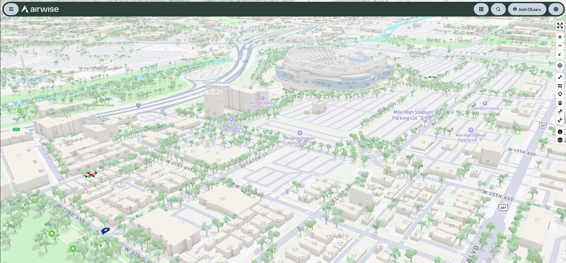
What happened
Airwise Solutions and UAS Sentry formed a partnership integrating UAS Sentry Nexus Remote ID detection into the Airwise Nexus platform, showing detected signals alongside drone operations, airspace data and FAA services.
Why it matters
Operators gain a common operating picture, letting them compare detected drones with approved missions and known fleet activity, which may help distinguish authorized flights from aircraft needing attention.
What to watch
The integration relies on drones that transmit Remote ID signals and will not detect every aircraft. Coverage depends on how many antennas organizations deploy.
WHO IT HITSCritical infrastructure, utility, airport and industrial site operators, plus public safety agencies managing drone activity near sensitive locations, gain a way to compare detected Remote ID signals with their approved missions and fleet activity. Whether that picture is complete depends on which drones transmit Remote ID signals, since the system will not detect every aircraft.
Ask the AI about this article →
Summaries like this, in your inbox every morning.
The partnership joins two pieces of the low-altitude picture that have largely been separate: detecting drones and managing drone operations. UAS Sentry Nexus handles the detection side, identifying drones that transmit Remote ID signals and, depending on the broadcast type, providing a drone's location and control station information. Airwise Nexus handles the operations side, covering mission planning, fleet and pilot management, airspace authorizations, analytics and UAS Traffic Management.
By connecting the two, the companies say organizations can compare detected drones with approved missions, planned flights and known fleet activity, rather than simply knowing a drone is present. Airwise's Chief Revenue Officer, John Powers, framed the goal as understanding what is happening in an airspace and how it relates to an organization's own operations.
The system is built to scale: UAS Sentry Nexus can support between three and 18 independently processed antennas through one LAN or LTE connection, and its open API links with third-party command, control, mapping and situational awareness platforms. UAS Sentry also develops its software and firmware in the United States and completes final assembly there.
The limits are worth noting. The integration only applies to drones that transmit Remote ID signals and will not detect every aircraft, so it is one source of information rather than a complete picture. How much visibility a given site actually gets is likely to hinge on how many antennas it deploys and how many drones in its airspace broadcast Remote ID.
For example, today's edition would include:
AI-summarized, only the topics you pick — one digest a day via Email, Slack, or Discord.
Free · 30 seconds with Google · unsubscribe anytimeWhat is AIToday? →
Ask AI anything about this article. Q&As are published on this page for other readers too.
AIVE AI Systems demoed Atlas GEO Cloud and Atlas GEO QGIS at INTERGEO 2026 in Munich — tools that build georef…

ITRI held its ITRI Innovation Day on September 15 in Tainan, Taiwan, bringing together research groups and sta…

TDK said it has started mass production of multilayer ceramic capacitors rated at 100V and 10μF, targeting AI…

TDK has introduced a 10μF version of its MLCC that uses the company's own resin electrodes, with the design ai…
Two AI-equipped robots appeared for a limited time at "Caricoco" near Kariya Station's north exit

Harmoni raised $10 million in Series A funding on Sept