What happened
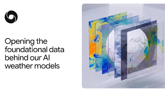
Google DeepMind released SatWeave, a global mosaic of geostationary satellite imagery updating hourly across 17 channels, and PARDIG, an AI global precipitation dataset at 15-minute resolution with a historical archive from 1999 to 2026.
Why it matters
Both datasets are key to the recently released WeatherNext 3 model, and their open availability lets researchers build weather, hydrology, and climate applications, including in regions lacking dense ground measurements, according to DeepMind.
WHO IT HITSWeather and climate researchers, hydrologists, and developers building flood, drought, or wildfire applications can now use these datasets, especially in regions without dense ground radar networks.
Summaries like this, every morning.
Google DeepMind's release builds on its recent WeatherNext 3 model, which relied on both datasets for its advances. SatWeave addresses a long-standing difficulty in combining satellite imagery: the five satellites it draws from use different map projections, file formats, sensors, and scan schedules ranging from 10 to 30 minutes. Most existing global composites drop incompatible aspects, offering only four or fewer channels or updating every few hours. SatWeave instead blends six geostationary satellites into a 17-channel mosaic that updates hourly, allowing WeatherNext 3 to produce new global predictions rather than waiting for analysis data refreshed every six hours.
PARDIG tackles precipitation tracking, where ground radars and rain gauge networks are not always available or well-distributed. Built on an AI architecture similar to WeatherNext 3 and trained on sparse spaceborne radar observations from NASA's GPM Core Observatory, it produces a global precipitation map at 15-minute temporal resolution and roughly 10-kilometer resolution with an average latency of about five hours. Evaluations against three continental radar networks and over 36,000 weather stations worldwide found it outperforms leading global baselines, including NASA's IMERG-Final, and proved particularly effective at capturing extreme precipitation events that existing products struggle to detect.
Because PARDIG learns directly from satellites rather than relying solely on ground measurements, DeepMind expects it to have reliable accuracy everywhere on Earth, including areas without ground data. The company is positioning the open datasets as a way to let researchers explore improved models for floods, landslides, and drought, especially in regions without dense ground radar networks.
Pick your industry and the AI tools you use, and get news related to your work every day.
Free · 30 seconds with Google · unsubscribe anytimeWhat is AIToday? →
Ask AI anything about this article. The AI reads this article, earlier AIToday articles, and Wikipedia, and cites its sources. Q&As are published on this page for other readers too.
Jamie Dimon said JPMorgan Chase is "not gonna allow just any" outside AI agent inside the company, warning "Yo…
Hithink RoyalFlush Information Network (valued at about CN¥149.23b) and SSI Securities (about ₫60.6t, 44.4% ne…
Interconnects argues Jensen Huang's resignation from Nvidia removes open models' biggest backer, warning his f…

OpenAI is dissolving its standalone robotics team and folding researchers into the main research team under Ch…
Bitfarms became Keel Infrastructure on April 1, 2026, moving its domicile from Canada to the U.S
A Fortune commentary argues Nvidia became the poster child for corruption in U.S