What happened
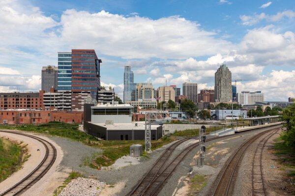
Raleigh created a digital twin of the city with tech partners Esri, NVIDIA and Microsoft, using four drones to capture imagery and AI to produce 3D models. It has aided planning for the 18.5-acre Gipson Play Plaza and tree preservation.
Why it matters
City officials say the digital twin lets them show residents how development and traffic decisions play out rather than just describe them, and it reflects demand: development and traffic top the city's citizen survey every two years.
What to watch
The city is starting to fold Internet of Things sensors, cameras, scooters and vehicles into the twin for a higher-fidelity view, and is working with a firm on micro-weather modeling of ventilation corridors.
WHO IT HITSUrban planners, GIS and IT staff at fast-growing cities get a working example of combining drone imagery with AI to visualize development and traffic scenarios. Drone operators and drone-makers serving government clients may see procurement shift toward NDAA-compliant, Blue Listed aircraft such as the Freefly Astro.
Summaries like this, in your inbox every morning.
Raleigh's effort did not start with the digital twin. The city's Parks Department began its first drone program in 2018, and the IT department started its own about two years ago, producing a decentralized setup in which drones operate in IT, Raleigh Parks and Raleigh Water, while the police department runs its own larger fleet separately because of the law enforcement nature of its work.
The digital twin itself is an outgrowth of that base. City leaders, viewing Raleigh as one of the fastest-growing cities in the country, decided the earliest use of the technology should be modeling the city's future urban form. From there the applications broadened: Gipson Play Plaza in Dorothea Dix Park, event planning that no longer relies on estimates of whether a space can hold a tent, siting buildings to preserve the city's stately oaks, and micro-weather modeling of wind patterns and ventilation corridors. Jim Alberque, the city's GIS and emerging technology manager, frames the value as communication — showing residents the story of the city rather than telling it.
The next test appears to be fidelity. Raleigh is starting to incorporate traditional Internet of Things devices, cameras, scooters and vehicles into the twin for a much more high-fidelity view, a step that hinges on how cleanly those separate data sources merge with drone imagery. For other fast-growing municipalities watching, the more instructive part may be the drone procurement: the shift to NDAA-compliant, Blue Listed aircraft such as the Astro was driven by the possibility of federal bans on Chinese-made drones, and it suggests how city fleets may be assembled from here.
For example, today's edition would include:
AI-summarized, only the topics you pick — one digest a day via Email, Slack, or Discord.
Free · 30 seconds with Google · unsubscribe anytimeWhat is AIToday? →
Ask AI anything about this article. Q&As are published on this page for other readers too.
A Nikkei piece frames China as a "humanoid robot superpower" (ヒューマノイド大国) and asks what can be learned from it
At an IMTS media panel in Chicago, Honeywell Technologies CTO Mehul Patel predicted companies will eventually…
CEO Jim Taiclet told a Morgan Stanley panel Lockheed will pair the F-35 and advanced missiles with cheaper aut…
Lockheed Martin completed a Riyadh summer internship for Saudi university students in AI, robotics and advance…

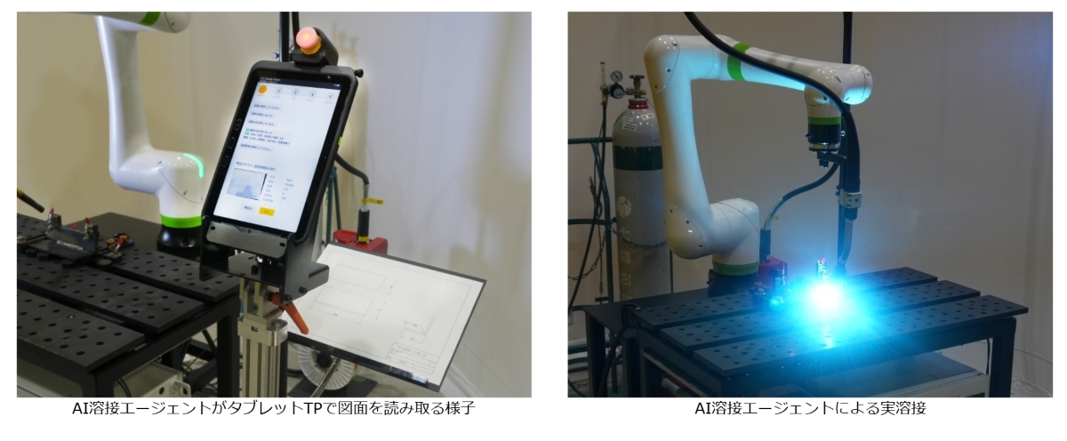
Google and Fanuc developed a welding robot that uses generative AI to read drawings and perform "zero teaching…
Riyaaz Shaik and Chandru Venkataraman introduced REVERSAL-BENCH, which controls reversibility via a parameter…